The Seasons, They Are a-Changin’
2012-09-15 16:26:11.000 – Stephen Lanciani, Summit Intern
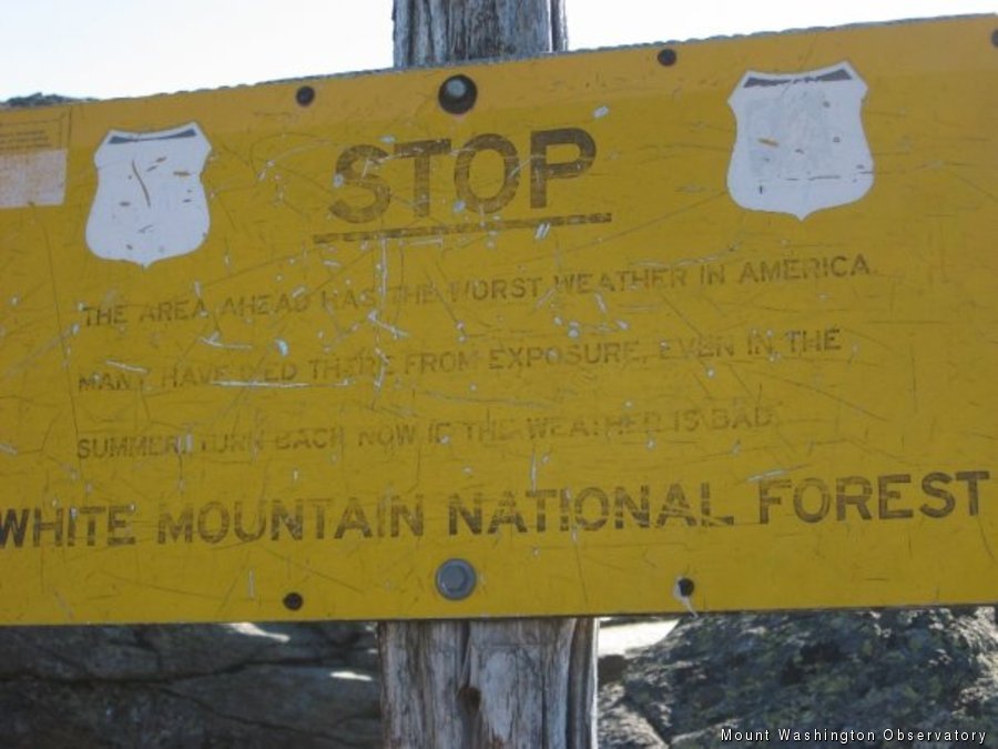
A warning sign of the
One of the most common topics of discussion regarding the weather on Mt. Washington is how quickly things can change. The reason the “Rockpile” is home to the “World’s Worst Weather” is not only because of the severity of storms, but also because of the rapid deterioration of conditions. The transition from yesterday to today was a prime example of this. High pressure had been providing pleasant weather for the region with clear, sun-filled skies and unseasonably mild temperatures due to a warm southeasterly breeze. A high temperature of 59 degrees was recorded on Friday and winds struggled to reach 15 mph for much of the day. There were times when we almost had to remind each other that it was September 14th, a time when average wind speeds are near 30 mph and average daily temperatures are in the low 40s. Mt. Washington’s reputation for poor weather was not to be cast off however, as conditions worsened drastically overnight. By midnight on Saturday, winds had increased to sustained speeds around 40 mph, with gusts in the 50s. Temperatures had plummeted to 45 degrees, 14 degrees cooler than the high for the day. By 6 AM, winds were sustained between 50 and 60 mph with gusts near 70 mph, and temperatures had fallen into the upper 30s. Since then, today has featured foggy conditions with zero visibility, rain showers, and temperatures in the mid 30s that will fall well below freezing tonight, making for icy conditions. Quite the change if you ask me!
So why did this happen, you ask? Well today, class, we will discuss fronts and pressure systems! By definition, fronts are boundaries between air masses, but can also be noted as transition zones depending on the strength of the temperature gradient. There is usually a notable wind shift with the passing of a front, due to the counterclockwise rotation of low pressure systems. Fronts branch out off of low pressure systems, and act as significant weather makers/changers. There are four different types of fronts which you can read about HERE, but to avoid writing a novel I will focus on the front that passed through and caused our weather change, the cold front. Cold fronts mark boundaries where cold air replaces warm air. As warm air gets lifted up over the cold air, the rising motion can act as a mechanism to spur showers or thunderstorms. This is what brought us rain showers this morning. Also, winds shifted behind the front, from southeast to northwest. Depending on the direction of the wind, warm or cold air can be advected (drawn in, essentially) to the area. Our warm temperatures Friday were primarily due to the mild airmass overhead, but were also helped by warm southwesterly flow. As the cold airmass behind the front moved in, winds shifting to the northwest allowed for cold Canadian air to flow into our area, causing our drop in temperature.
That leaves just the winds to be explained. Winds are slightly different, in that they do not necessarily increase or decrease as a result of fronts. Rather, they increase or decrease based upon the pressure gradient between high and low pressure systems (areas of locally higher and lower pressure, respectively). Fluids (air in this case) travel from high to low pressure. When we are between a high pressure system and a low pressure system, we get caught directly in this flow of air that we call wind! The speed of the wind depends on the strengths of the high and low pressure systems. A greater difference equals a stronger gradient, thus equaling stronger winds. Our recent wind increase has come as a result of transitioning from high pressure yesterday, to the low pressure in place today.
This example of how and why conditions change so quickly is all the more reason to plan ahead! By viewing forecasts and having a flexible schedule, you can know days in advance when the weather will be bad and plan around it to have a safe and enjoyable trip to the summit.
Observer Footnote: Now through September 19, the Mount Washington Observatory is competing against thousands of nonprofits across the country for a share of $5,000,000 through the Chase Community Giving contest. Nearly 200 charities will be awarded grants through this contest, and Mount Washington Observatory has a legitimate shot at winning a grant of up to $250,000 to support its work in research and education. Grants are awarded to the top vote-getters, so I’m asking for your help. Please cast a vote for the Observatory! To do so go HERE!,
Stephen Lanciani, Summit Intern
Seek the Peak Spotlight: Sandy and Joan Kurtz
Seek the Peak Spotlight: Sandy and Joan Kurtz By MWOBS Staff Sandy and Joan Kurtz have been active supporters of Mount Washington Observatory for almost five decades. After visiting North Conway in 1980, they
Living the Night Life
Living the Night Life By Madelynn Smith My alarm goes off in the bunkroom, with blackout curtains obscuring the sun’s rays as it begins to lower in the sky. My day starts in the
Three and a Half Months of Snow, Ice and Rime
Three and a Half Months of Snow, Ice and Rime, with Deeper Drifts. By Ryan Steinke Me outside on the summit near the Yankee Building. My internship with the Mount Washington Observatory


