
Tracking Jose and the Tropics
2017-09-17 14:29:56.000 – Tom Padham, Weather Observer/Education Specialist
Jose is a long lived tropical system, having formed back on September 5th. Jose will likely remain at least a tropical storm through next Friday, the 22nd, giving it a total lifespan as a tropical system of 14+ days. This is still not even close to the longest-lived tropical system, Hurricane John in 1994. John formed as a hurricane in the far eastern Pacific off the coast of Mexico on August 11th, 1994. 31 days later, on September 10th tropical storm John finally dissipated south of the Aleutian island of Alaska after having traveled 7,165 miles!
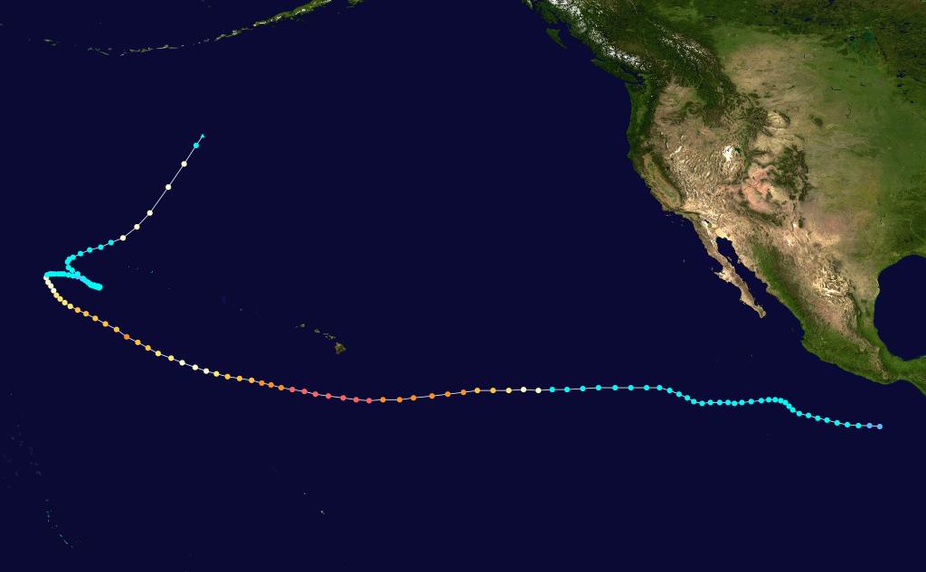 Hurricane John’s track across the Pacific in 1994.
Hurricane Jose reached peak intensity as a Category 5 with 155 mph on September 9th. This was the first time in recorded history in the Atlantic that two hurricanes with winds of 150 mph or greater occurred at the same time, with Hurricane Irma moving just offshore of Cuba at the time with 150 mph winds.
 Hurricane Jose official forecast track and predicted strength at the 11:00 AM EDT update
This has already been a very busy Atlantic hurricane season, with 14 named storms as of this writing. An average hurricane season has only 10 named storms, so we’re already above the average year despite still having through November for the typical season. Besides Jose, tropical storm Maria bears attention due to it’s predicted track and strength.
Maria is forecasted to become a major hurricane as it tracks across the Leeward Island and towards Puerto Rico, both areas that were recently hit hard by Hurricane Irma. By Friday the storm will likely still be a hurricane just north of the island of Hispaniola. After this point the hurricane could continue a northwestward motion towards the East Coast, or potentially be turned northwards and take a similar path to that of Jose.
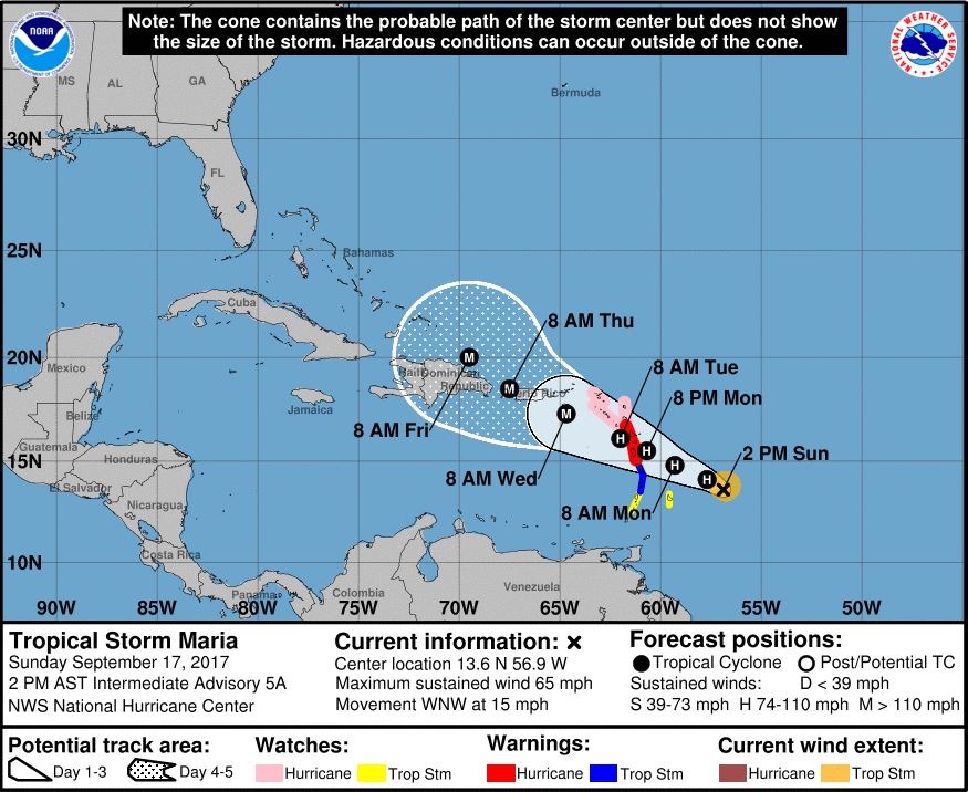 Tropical Storm Maria official forecast track and predicted strength at the 2:00 PM AST update
With the damage of Harvey and Irma still fresh in the minds of the entire country it serves as a reminder that we all should be prepared in the event of any natural disaster. For help starting your emergency preparedness kit, head to https://www.ready.gov/build-a-kit. The National Hurricane Center at http://www.nhc.noaa.gov/ is a great resource with information on how to prepare for a natural disaster. Our fellow Americans could still also use your support in the ongoing clean up and rebuilding after Irma and Harvey; consider making a donation to the Red Cross for disaster relief at https://www.redcross.org/.
Tom Padham, Weather Observer/Education Specialist

Home Sweet Summit
Home Sweet Summit By Kathryn Hawkes Me enjoying the view of Mount Washington while skiing in the valley on my off week. Hi everyone! My name is Kathryn Hawkes and I’m the

Meet MWOBS/MWAC Intern Ryan Tanski
Meet MWOBS/MWAC Intern Ryan Tanski By Ryan Tanski Hello! I’m Ryan Tanski and I’m the joint USFS Mount Washington Avalanche Center and Mount Washington Observatory Intern this winter. I’m thrilled to get to work

Geologist Climbs Rock Pile, Looks Up
Geologist Climbs Rock Pile, Looks Up By Bailey Nordin Hello from the summit of Mount Washington! My name is Bailey Nordin, and I am the newest Weather Observer and Education Specialist joining the team
