Vernacular Confusion
2018-03-23 12:16:16.000 – Sarah Schulte, Summit Intern
“You keep using that word. I do not think it means what you think it means.”
– Inigo Montoya, The Princess Bride
The field of meteorology is chock-full of terminology, and these terms are used by a wide variety of meteorologists. Researchers, observers, broadcasters…they all have a need to get their information out to their audience. Because of the wide variety of weather professionals and the even wider variety of the audiences with whom they communicate, it’s easy for those unfamiliar with the vernacular to use the words incorrectly. Since many of these terms pertain to winter weather and I’m still getting used to them (being from further south), I decided to take a closer look at a few words that have become more widely used in the past few years.
Polar Vortex
As defined by the National Weather Service (NWS), the polar vortex is “a large area of low pressure and cold air surrounding both of the Earth’s poles”. This low pressure area is a permanent fixture in the poles and has always existed. It also sits high up in the atmosphere, not at the Earth’s surface.

Diagram of the Polar Vortex from the NWS.
The term ‘polar vortex’ became popular when it was reported in association with large outbreaks of Arctic air in the United States. Although it never moves from the poles and never disappears, the polar vortex does fluctuate in power and spread and becomes stronger in the winter season. It affects the United States (and parts of Europe and Asia) when it expands and sends cold air southward. This Arctic air moves with the jet stream, and since the positioning of the jet stream changes, that means there’s potential for this frigid air to affect areas it might not usually reach. To sum up, the polar vortex doesn’t appear and disappear and it doesn’t physically move into the United States, but it can strengthen and send extremely cold air our way. If you hear mention of it, get ready to layer up!
Bomb Cyclone
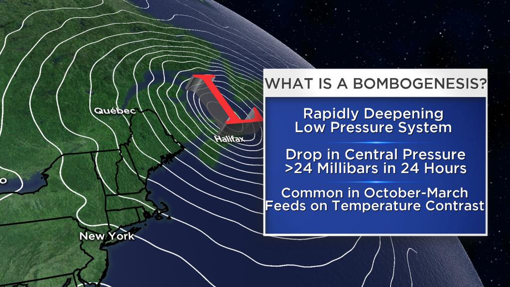
We’ve had some impressive Nor’easters move through our area this year (for more detail on Nor’easters, see Jillian’s previous post). Another term has popped up frequently as this train of tempests tore through New England: bomb cyclone. ‘Bomb cyclone’, as well as its synonym ‘weather bomb’, is, according to Met Office, “an unofficial term for a low pressure system whose central pressure falls 24 millibars in 24 hours.” The meteorological term for this phenomenon is ‘explosive cyclogenesis’.

Explanation of ‘bombogenesis’, another term for explosive cyclogenesis (graphic from www.liveweatherblogs.com)
Intense pressure drops are important to classify because they generate strong winds, and if this happens quickly, the impacts can be severe. Some of the storms this year have met the criteria for explosive cyclogenesis. However, not every storm that leaves an impact undergoes this deepening in pressure. ‘Bomb cyclone’ isn’t a term to use for any storm that may cause trouble. Rather, ‘explosive cyclogenesis’ is used to specify that a low pressure system will drop at least 24 millibars of pressure in 24 hours. It’s an impressive feat, but it’s frequently attached to storms that don’t merit the title.
Wind Chill
In an environment that can be as cold as that of the White Mountains, ‘wind chill’ is a very important term to use correctly. Wind chill is a value that takes temperature and wind speeds into account, but it isn’t the actual air temperature. As explained by the NWS, “it takes into account heat loss from the human body to its surroundings during cold and windy weather”. The human body will lose more heat in stronger winds, and if temperatures are already cold to begin with, then the heat loss will be even worse. For example, a wind chill value of 30 below zero indicates that your body will lose heat as if the temperature of the air was 30 below zero on exposed skin. The actual temperature won’t be this cold, but the strong winds accompanying the temperature will make your body lose heat more rapidly.
All three of these terms (polar vortex, bomb cyclone and wind chill) have a tendency to be misused. It’s important to keep in mind, however, that when used correctly, these terms represent weather events and conditions that can pose danger to the unprepared. Knowing exactly what they mean allows for better preparation when venturing out into the elements. Inconceivable? I think not!
Sarah Schulte, Summit Intern
Three and a Half Months of Snow, Ice and Rime
Three and a Half Months of Snow, Ice and Rime, with Deeper Drifts. By Ryan Steinke Me outside on the summit near the Yankee Building. My internship with the Mount Washington Observatory
Supporter Spotlight: Righteous Vices Coffee Roasters
Supporter Spotlight: Righteous Vices Coffee Roasters By MWOBS Staff Righteous Vices Coffee Roasters, a local coffee roaster and shop located in Center Conway, New Hampshire, has been a partner of the Observatory since 2024.
Winter Storm Tracks Across New Hampshire
Winter Storm Tracks Across New Hampshire By Alex Branton As winter comes to a close, most of us are ready for the warmer temperatures and sunshine that come with Spring and Summer. Although we


