Warm Up Ahead
2013-01-27 23:34:44.000 – Mike Carmon, Weather Observer/Meteorologist
NULL
It’s hard to believe what’s in the forecast.
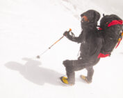
When we arrived on the summit nearly four-and-a-half days ago, the thermometer read a frosty 35 degrees below zero F. Wind chills were somewhere around 85 below F, and exposed skin while outdoors was absolutely forbidden.
Now, an inexplicable warming trend is in the cards, with temperatures expected to rise above freezing on Tuesday, and readings approaching 40 degrees F possible on Wednesday!The recent stretch of relatively precipitation-free weather, which often comes with such an arctic cold snap due to the lack of moisture in the air, has given us only .8 inches of snow over the past four days–a laughably-tiny number for late January, in a location that averages almost 53 inches of snow over the month, and nearly 300 inches of the white stuff per year!
This is about to change as well, although not in a wintry sense.
With the temperatures slated to skyrocket as I mentioned earlier, it looks as though a wintry mix on Tuesday will transition to a mostly rain event on Wednesday. This will most likely diminish the already feeble snow pack that exists on the summit.
What a topsy-turvy winter it’s been!
Mike Carmon, Weather Observer/Meteorologist
Seek the Peak 2026: New Adventures, Rooted in Tradition
Seek the Peak 2026: New Adventures, Rooted in Tradition By MWOBS Staff Seek the Peak is Mount Washington Observatory's largest annual fundraiser, and for 26 years it's brought together hikers, adventurers, and people who
What “Prepared” Really Means in the White Mountains
What “Prepared” Really Means in the White Mountains Early Spring in the Whites: The Most Honest Season By Andrew Harris, Burgeon Outdoor If you’ve spent any time in New Hampshire’s White Mountains in March,
March on Mount Washington
March on Mount Washington By Ryan Knapp Looking towards Mt. Madison at sunset on March 21, 2026. The calendar has spoken: Friday, 20 March 2026, marked the first day of astronomical spring.


