
White Christmas on the Horizon?
2014-12-18 17:37:39.000 – Kaitlyn O’Brien, Weather Observer/Education Specialist
An area of low pressure departing the region has brought some decent snowfall across the state over the past 48 hours with the higher summits and much of northern New Hampshire seeing the larger totals. As this low continues to propagate offshore, high pressure will move in for the weekend, bringing clear skies and fair conditions. Looking ahead, however, models are showing the possibility of what could potentially be a significant snowfall event for New England; just in time for Christmas!
Below are some images from the Global Forecast System, or GFS. This particular atmospheric model is produced by the National Centers for Environmental Prediction. If you’re interested in finding out more about this model, please see the GFS page, courtesy of the National Climatic Data Center. While this event is still far out, it certainly looks like something is brewing Christmas Eve.
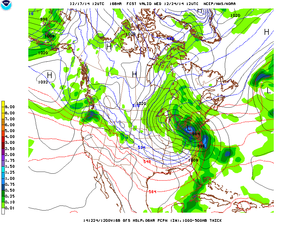 7AM Wednesday, courtesy of www.theweathergun.com
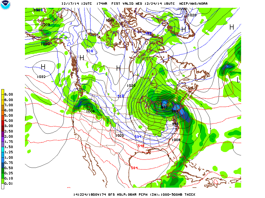 1PM Wednesday, courtesy of www.theweathergun.com
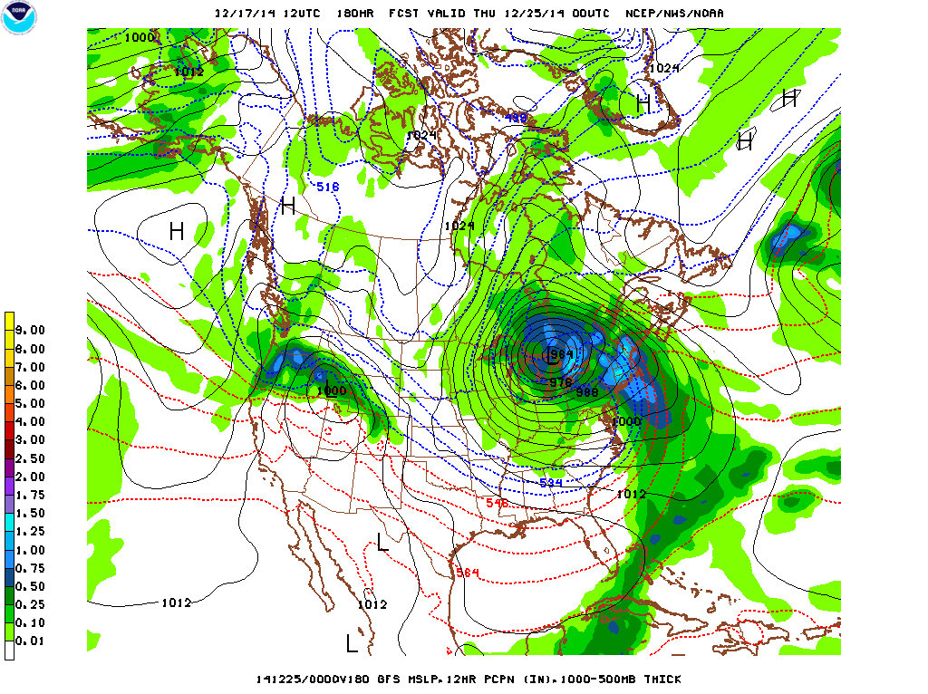 7PM Wednesday, courtesy of www.theweathergun.com
This sequence shows projected atmospheric conditions for next Wednesday, December 24th. The times of each image correlate to 7AM, 1PM, and 7PM. While Christmas Eve looks rather ominous right now, these are the types of events that often have meteorologists “wish-casting”. At this point in time, it is too far out to come up with snowfall totals. Additionally, if both this storm and the storm track do indeed verify next week, it looks like much of New England will be in what is known as the “warm sector”. With a leading warm front as well as a southeasterly flow due to areas of low pressure spinning counterclockwise, the temperatures may be too warm for a total snowfall event. Even so, winter weather is not that simple. There are additional factors that must be considered when it comes to determining a mixed precipitation event versus a snow event. Ultimately, it is the surface temperatures and the air temperatures aloft that will make the final decision.
So for now, this system is on our radar and it is something we will be monitoring through the weekend. As the weather models continually update, more information will be available. Meteorological models have certainly progressed a long way over the years, thanks to the increased power of supercomputers, as well as a vast network of surface observations. While the forecasts may be improving, it’s important to remember too, that the forecasts are also always changing. Be sure to check back frequently for updates!
Please support the nonprofit Mount Washington Observatory year-end campaign. Join us on our journey as we Aspire to Climb Higher. Please consider a tax-deductible gift today!
Kaitlyn O’Brien, Weather Observer/Education Specialist

Seek the Peak Spotlight: The Cloud Chasers
Seek the Peak Spotlight: The Cloud Chasers By MWOBS Staff Mike Bergeron and Desiree Bolton have been participating and volunteering for Seek the Peak for three years now. Together, they comprise Team Cloud Chasers

Celebrating 250 Years: The Declaration’s Legacy in the White Mountains
Celebrating 250 Years: The Declaration's Legacy in the White Mountains By Peter Crane We are now approaching July Fourth, Independence Day, the day when we celebrate the adoption of the Declaration of Independence in

Seek the Peak Spotlight: Ryan Shepard
Seek the Peak Spotlight: Ryan Shepard By MWOBS Staff Before Ryan Shepard moved to Conway, he was in Western New York celebrating his 40th birthday party. “I wanted to go big,” he said. “Big”
