
Winter Storm
2011-11-22 08:50:06.000 – Kevin Cronin, Summit Intern
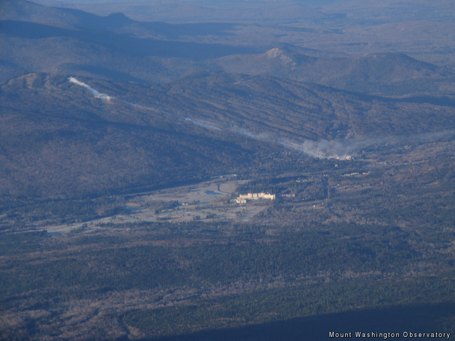
A base layer of snow before the storm arrives
The top of Mount Washington is bare of snow besides a few spots of snow here and there. However, this will surely change in the next 24 hours as a winter storm approaches from the southwest. Bretton Woods ski resort is already preparing by putting down a base layer of snow before the storm arrives tomorrow. A plume of artificial snow can be seen from the image I attached. Winter storm warnings are in effect for most of northern New Hampshire as the models predict a favorable track for snow. Cold air damming and evaporative cooling will prevail over warm air advection produced by the storm allowing the majority of the precipitation to be snow in northern New Hampshire. Traveling farther south in New Hampshire snow will begin to mix with ice pellets and rain as warm air advection provides a warmer layer aloft warming temperatures above freezing. Models are showing snow totals of 10+ inches and less as you head farther south.
This storm couldn’t of picked a worse day for New England seeing that the Wednesday before Thanksgiving is one of the heaviest traveled days. Unfortunately it is bad timing for the summit too due to the fact that our shift change is on Wednesdays. In order to avoid the storm Wednesday, shift change will actually occur today in the afternoon.
Kevin Cronin, Summit Intern

Seek the Peak 2026: New Adventures, Rooted in Tradition
Seek the Peak 2026: New Adventures, Rooted in Tradition By MWOBS Staff Seek the Peak is Mount Washington Observatory's largest annual fundraiser, and for 26 years it's brought together hikers, adventurers, and people who

What “Prepared” Really Means in the White Mountains
What “Prepared” Really Means in the White Mountains Early Spring in the Whites: The Most Honest Season By Andrew Harris, Burgeon Outdoor If you’ve spent any time in New Hampshire’s White Mountains in March,

March on Mount Washington
March on Mount Washington By Ryan Knapp Looking towards Mt. Madison at sunset on March 21, 2026. The calendar has spoken: Friday, 20 March 2026, marked the first day of astronomical spring.
