
Winter’s Return
2015-01-22 19:23:46.000 – Caleb Meute, Weather Observer/Education Specialist
Great news for skiers and snow lovers across New Hampshire as high pressure looks to remain in the forecast into the weekend before low pressure and unsettled weather will eventually make a return. This means that skies will be mostly clear tonight through Friday night and temperatures will be below freezing, allowing ski resorts to continue to build onto their existing snowpack.
This weekend looks quite interesting as we have two separate areas of low pressure which will make their ways towards New England potentially dropping accumulating snow throughout much of New Hampshire. The center of low pressure which will be moving up the eastern seaboard will bring bountiful moisture into New England, and with a quick moving low diving down from Canada, much colder air will be introduced as well. While these are the ingredients that can lead to a major snowstorm for New England, everything is not quite in place per the most recent forecast models. The area of low pressure moving up the eastern seaboard currently looks like it will take a track well offshore in the Gulf of Maine which would likely only result in measurable snowfall for areas in southern New Hampshire. With that being said, the path the low will be traveling is still uncertain. If the path of the low tracks further to the west along the East Coast then this will allow for snow accumulation to extend further into New Hampshire. As of today, it looks like the snow over southern New Hampshire will begin during the early evening hours on Saturday and will last into Sunday morning.
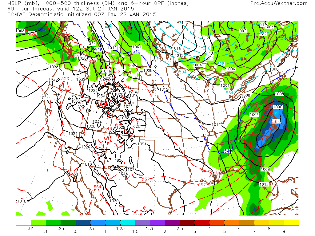 Saturday January 24 7AM: Surface map showing the two separate low pressure systems approaching New England. The low over the Carolina Coast will eventually take the energy from the Canadian low pressure system which will help it to intensify as it moves into the Gulf of Maine. Image courtesy of www.accuweather.com
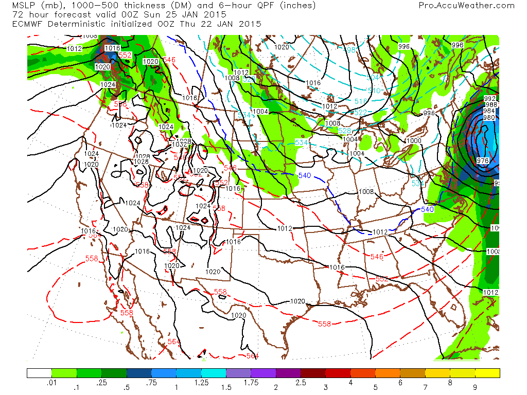 Saturday Jan 24 7PM: Surface map showing the center of low pressure which begins to intensify offshore leading to potential snowfall over southern New Hampshire. Image courtesy of www.accuweather.com
Caleb Meute, Weather Observer/Education Specialist

Seek the Peak Spotlight: The Cloud Chasers
Seek the Peak Spotlight: The Cloud Chasers By MWOBS Staff Mike Bergeron and Desiree Bolton have been participating and volunteering for Seek the Peak for three years now. Together, they comprise Team Cloud Chasers

Celebrating 250 Years: The Declaration’s Legacy in the White Mountains
Celebrating 250 Years: The Declaration's Legacy in the White Mountains By Peter Crane We are now approaching July Fourth, Independence Day, the day when we celebrate the adoption of the Declaration of Independence in

Seek the Peak Spotlight: Ryan Shepard
Seek the Peak Spotlight: Ryan Shepard By MWOBS Staff Before Ryan Shepard moved to Conway, he was in Western New York celebrating his 40th birthday party. “I wanted to go big,” he said. “Big”
