Wintry Mix Ahead?
2015-03-12 15:57:42.000 – Kaitlyn O’Brien, Weather Observer/Education Specialist
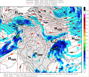
 2AM Saturday morning forecast: Two areas of interest; a Clipper developing along the Canadian border and a disturbance moving up from the south. Courtesy of UQAM Weather Centre
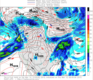
 The disturbance to our south becomes more organized by 8AM Saturday morning. Courtesy of UQAM Weather Centre
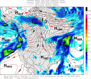
 2PM Saturday afternoon: The heaviest precipitation will occur Saturday afternoon and evening. Courtesy of UQAM Weather Centre
Kaitlyn O’Brien, Weather Observer/Education Specialist
Bringing Polar Byrd I to Mount Washington
Bringing Polar Byrd I to Mount Washington By Jackie Broccolo In 1968, my grandfather joined the Polar Byrd I “Dustin Transpolar Flight”, which was the first commercial flight to carry civilians across both poles
Seek the Peak 2026: New Adventures, Rooted in Tradition
Seek the Peak 2026: New Adventures, Rooted in Tradition By MWOBS Staff Seek the Peak is Mount Washington Observatory's largest annual fundraiser, and for 26 years it's brought together hikers, adventurers, and people who
What “Prepared” Really Means in the White Mountains
What “Prepared” Really Means in the White Mountains Early Spring in the Whites: The Most Honest Season By Andrew Harris, Burgeon Outdoor If you’ve spent any time in New Hampshire’s White Mountains in March,


