Wintry Weather Ahead!
2015-12-17 19:55:17.000 – Tom Padham, Weather Observer/Meteorologist
After a very warm and mild start to the winter season so far across the higher elevations of New England, we’re all anxious for more in the way of snow, cold, and the high winds that make Mount Washington famous. The summit has been seeing rain and freezing rain today as temperatures hover near the freezing mark, which is roughly 15 degrees above average for mid-December. Behind this system much colder air will move in to northern New England.
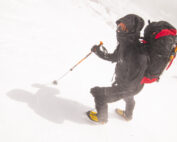
Beginning Saturday, temperatures will struggle to rise out of the single digits, with persistent upslope snow showers as an upper level low pressure moves north of the area. Lake effect snow bands over lakes Erie and Ontario will also potentially enhance some of the snow shower activity across the Green and White Mountains over the weekend, leading to the possibility of snow squalls. On top of this, winds will be frequently gusting over hurricane force late Saturday and Sunday, with wind chills bottoming out around 40 below. Please be sure to dress appropriately for these conditions if heading above tree line over the weekend, and check out the current summit conditions page to see what the latest conditions are. Safe to say that more December-like weather will be occurring over the weekend on Mount Washington, and we’re all looking forward to observing the weather that makes this mountain famous!
Tom Padham, Weather Observer/Meteorologist
Seek the Peak 2026: New Adventures, Rooted in Tradition
Seek the Peak 2026: New Adventures, Rooted in Tradition By MWOBS Staff Seek the Peak is Mount Washington Observatory's largest annual fundraiser, and for 26 years it's brought together hikers, adventurers, and people who
What “Prepared” Really Means in the White Mountains
What “Prepared” Really Means in the White Mountains Early Spring in the Whites: The Most Honest Season By Andrew Harris, Burgeon Outdoor If you’ve spent any time in New Hampshire’s White Mountains in March,
March on Mount Washington
March on Mount Washington By Ryan Knapp Looking towards Mt. Madison at sunset on March 21, 2026. The calendar has spoken: Friday, 20 March 2026, marked the first day of astronomical spring.


