
Incoming Wind Event
2016-11-10 16:06:42.000 – Taylor Regan, Summit Intern
An incoming cold front will bring gusty winds and the lowest temperatures of the season thus far to the summit, beginning tonight and lingering through the weekend. Winds will be sustained above hurricane force for much of this time, with gusts approaching 100 mph.
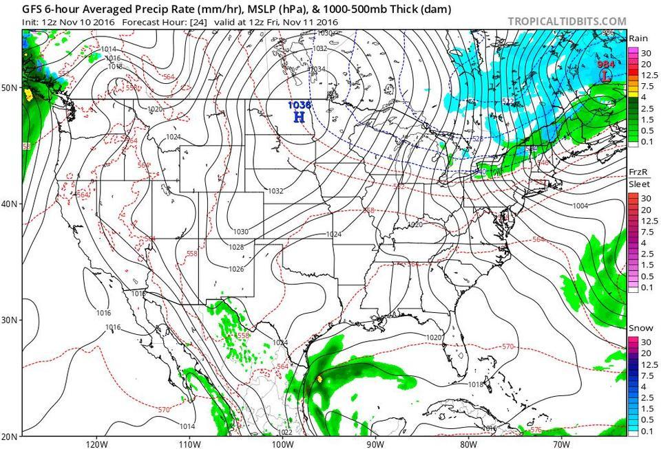
Why are we expecting such high winds with this event? One reason is the pressure gradient associated with the passage of the front. Looking at the map below, imagine that the gap between each set of lines represents a “step.” Furthermore, to get from an area of low pressure to an area of high pressure, you have to “climb” all the steps, and vice versa to descend from higher pressure to lower pressure. Sometimes, the pressure gradient, or number of steps between high and low pressure areas, is not very steep; the centers of these systems may be very far apart, and therefore, the steps are very spread out, or, the high and low pressures may not be very high, or low, and therefore, not as many steps are needed to get from one system to the other.
Interested in trying some gust forecasting of your own? There’s still time to enter your guess for the highest wind speed and coldest temperature we’ll see on the summit out of this event through the link on our facebook page. Once you’ve entered your guess, feel free to check out the current summit weather conditions by going to our homepage at www.mountwashington.org to monitor how close your gust guess is!
Taylor Regan, Summit Intern

Seek the Peak Spotlight: The Cloud Chasers
Seek the Peak Spotlight: The Cloud Chasers By MWOBS Staff Mike Bergeron and Desiree Bolton have been participating and volunteering for Seek the Peak for three years now. Together, they comprise Team Cloud Chasers

Celebrating 250 Years: The Declaration’s Legacy in the White Mountains
Celebrating 250 Years: The Declaration's Legacy in the White Mountains By Peter Crane We are now approaching July Fourth, Independence Day, the day when we celebrate the adoption of the Declaration of Independence in

Seek the Peak Spotlight: Ryan Shepard
Seek the Peak Spotlight: Ryan Shepard By MWOBS Staff Before Ryan Shepard moved to Conway, he was in Western New York celebrating his 40th birthday party. “I wanted to go big,” he said. “Big”
