
#MWOMetMonday
2015-09-07 15:03:31.000 – Mike Carmon, Co-Director of Summit Operations
Happy Labor Day to all!
Here’s our first question, courtesy of Jackie Keating, who posted the following on the Mount Washington Observatory’s Facebook page:

Pictured here is an anvil-shaped top of a passing thunderstorm. It’s clearly evident from this image that the location at which the picture was taken was not experiencing stormy conditions (like she mentions in the post, it’s a “clear sunny day”). However, intense thunderstorms can grow very large in size and vertical height, allowing their tops to be seen from many miles away.
The top of a thunderstorm gets its characteristic anvil shape because of the intense rising motion of air (or updraft) that develops within the storm. The clouds grow so tall that they can strike the top of the troposphere, which is the lowest layer of the atmosphere in which all of the weather we experience occurs. Here at the top of the troposphere, there exists a temperature inversion, which acts as an effective lid on the atmosphere. So, when this intense rising air hits this temperature inversion, the air is forced to spread out horizontally, forming the characteristic anvil shape seen in the image.
The second question of the day comes from Tom @Patsfantk on twitter:

The El Niño Southern Oscillation (ENSO), or “El Niño” for short, is a pattern observed in the sea surface temperatures (SSTs) of the equatorial region of the Pacific Ocean. During a so-called El Niño year, warmer-than-average SSTs are observed in these waters due to natural changes in ocean temperatures below the surface. These warmer-than-average SSTs can trigger a series of domino effects that have a major impact on the weather around the world, including North America.
This year’s El Niño is forecasted to be a significantly strong event. Generally speaking, a strong El Niño year will result in wetter and cooler winters across the western and southern United States, while the Pacific Northwest and Midwestern states typically experience drier and milder winters.
Up in the Northeast United States, the effects of an El Niño year have historically varied. Temperatures are generally near-average to slightly above-average across New England. As far as precipitation is concerned, trends have generally been towards higher-than-average precipitation totals during El Niño years, largely due to the increased frequency of storm systems passing through New England as a result of the position of the northern branch of the jet stream.
It’s important to remember that we’re speaking in terms of climatological trends, so nothing is set in stone for this winter. Especially if the ENSO begins to weaken, which could buck wintertime trends back towards normal.
Thanks again for your questions, Jackie and Tom!
Mike Carmon, Co-Director of Summit Operations
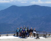
Meet MWOBS’ 2026 Seek the Peak Teams
Meet MWOBS’ 2026 Seek the Peak Teams By MWOBS Staff Another year, another epic Seek the Peak! As of June 2026, there are 430 hikers signed up for Mount Washington Observatory's annual summer fundraiser and
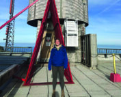
What the Rockpile Taught Me (Besides How to Dress for the Arctic)
What the Rockpile Taught Me (Besides How to Dress for the Arctic) By Kathryn Hawkes It turns out that living on the top of a mountain will teach you A LOT of things. How
Hiker Safety
Hiker Safety By Fawn Langerman, Dave Fatula and Julie Saccardo USFS Trailhead Steward volunteering season has begun, and hiker safety is on my mind. Truthfully, hiker safety is always on my mind, but more
