
A Brief Clipper Brings a Round of Fresh Powder!
2015-03-30 20:26:03.000 – Kaitlyn O’Brien, Weather Observer/Education Specialist
A brief Clipper is swinging through the Northeast, yielding scattered snow showers across the state. While the first round of precipitation moved in early this morning, additional snow will continue this afternoon and evening before tapering off early on Tuesday morning. Because this is a fast-moving system, significant snowfall amounts are not likely. Totals in the northern half of the state will be around 1-3 inches with higher localized amounts possible above 4,000’. The southern half of the state will see trace amounts after all is said and done.
Looking ahead however, skies will clear mid-week before another area of low pressure moves in during the Thursday-Friday timeframe.
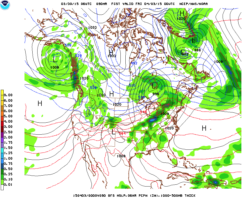 An area of low pressure moving into the Northeast Thursday at 8PM, image courtesy of The Weather Gun
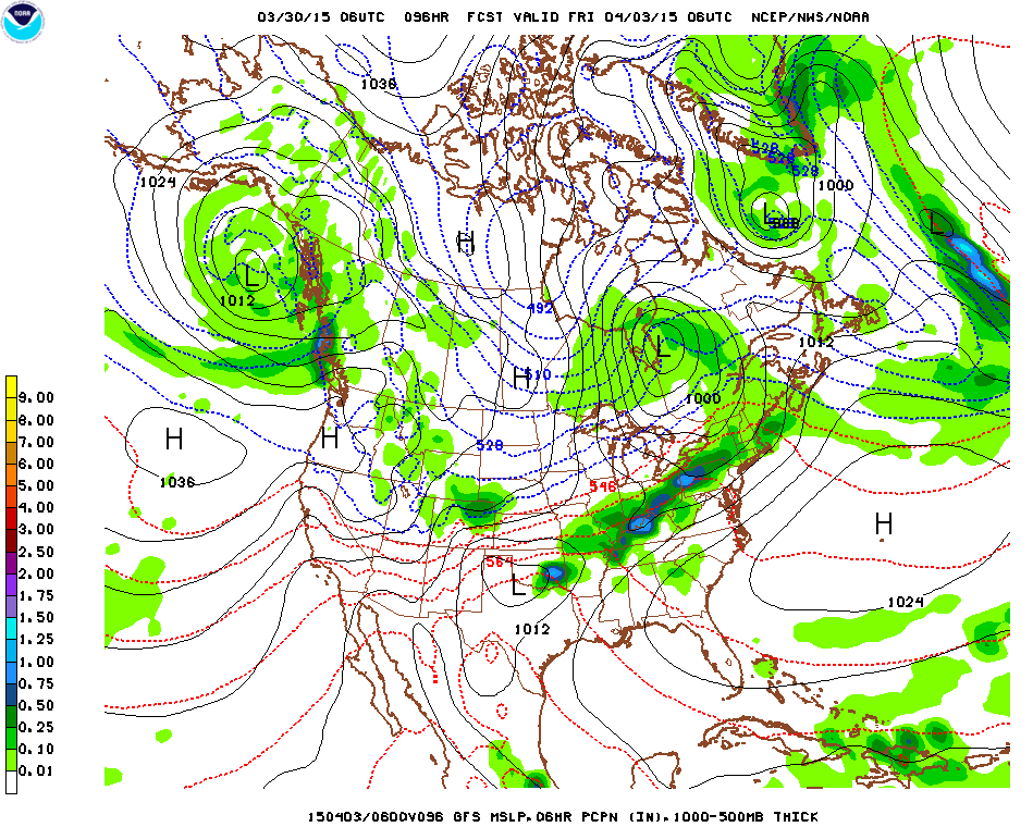 The low pressure strengthens a bit by 2AM Friday, image courtesy of The Weather Gun
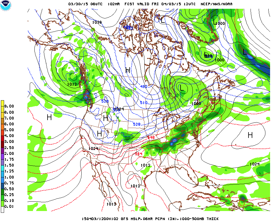 Friday 8AM: Lingering moisture moves through and eventually dissipates through the day on Friday, image courtesy of The Weather Gun
Precipitation types will be dependent upon temperatures, which at this point may be warm enough for rain, especially for southern NH. Until then, enjoy the newly fallen snow and the subsequent clear skies that follow! We’ll be sure to keep you updated.
Kaitlyn O’Brien, Weather Observer/Education Specialist

Celebrating 250 Years: The Declaration’s Legacy in the White Mountains
Celebrating 250 Years: The Declaration's Legacy in the White Mountains By Peter Crane We are now approaching July Fourth, Independence Day, the day when we celebrate the adoption of the Declaration of Independence in

Seek the Peak Spotlight: Ryan Shepard
Seek the Peak Spotlight: Ryan Shepard By MWOBS Staff Before Ryan Shepard moved to Conway, he was in Western New York celebrating his 40th birthday party. “I wanted to go big,” he said. “Big”

From Florida Heat to the Rockpile
From Florida Heat to the Rockpile By Alek Libby Hi everyone! My name is Alek Libby, and I am one of the summit interns here at Mount Washington Observatory this summer! I recently graduated
