
An Epic Storm Summary
2018-04-19 06:14:10.000 – Caleb Meute, Weather Observer / Meteorologist
As this past shift elapsed, our eyes turned to an impending storm that looked to bring a mess of wintry precipitation and STRONG winds Saturday through Tuesday. We became especially excited through the weekend as the storm setup looked eerily similar to the storm that brought the summit a 231 mph wind gust in 1934. The only difference was going to be the strength of the high and low pressure systems in play, so we knew that it would not be breaking any records, BUT we had a feeling the winds were going to roar. In the days leading up to the storm, the forecast personally had me pulling my hair out (I am bald now) (but not really). The issue was a strong temperature inversion that was going to set up beneath the summit, or so I thought. The colder air at the surface was the result of high pressure to the north sending a backdoor cold front into New England. I mistakenly forecasted for the summit to remain above the inversion and in a layer of air that would be above freezing, thus expecting our dominant precipitation type to be rain during the worst of the storm. As you are likely aware of now, this was not the case…
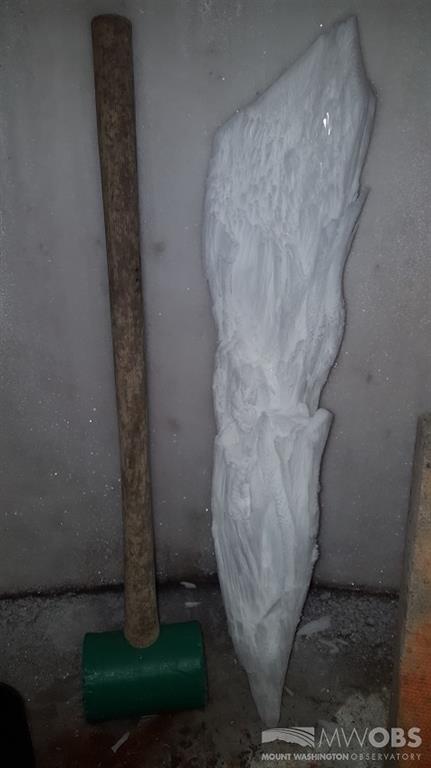
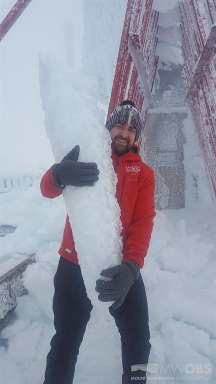
3 foot long rime ice feather plucked off of the tower!
The wind forecast was okay! The temperature and precipitation type were not. I went to bed Monday morning, already a little exhausted from battling glaze ice that had been accruing on our instrumentation for a few days straight. My anticipation was to wake up and hear the winds roaring, and heavy rain falling, assuming the mercury had risen above freezing. I woke up to what felt like an alternate reality if I am being perfectly honest. Upon waking up in the afternoon, Adam informed me that the temperature was in the teens and VERY heavy sleet had been falling through the afternoon. When it came time for my first observation at the start of my shift, I climbed to the top of the tower where it felt as though I was under fire from an army wielding BB guns. It was not JUST heavy sleet (and I mean HEAVY), it was very large sleet, forming in a convective nature. These large balls of sleet were coming at me at category 1 hurricane strength and occasionally hitting me along a gust over 100 mph. This may “sound” awful, but it was truly remarkable to experience… After my second observation, Adam and I went to the observation deck door to film a quick video to give everyone a taste of what was going on. As we were filming the video, we opened the door and realized the heavy sleet had transitioned to very heavy freezing rain that was causing glaze ice to form at a tremendous rate. The second that my phone was exposed to the freezing rain, wind and cold, it unfortunately died so we could not get the footage we were hoping for. To give you an idea of how hard the freezing rain was coming down, after being outside for a few minutes I came back inside and was covered in glaze ice myself.
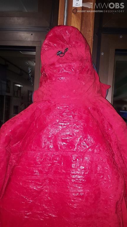
I took this right after coming inside from one of my observations. I was outside for a few minutes and became encased in glaze ice!
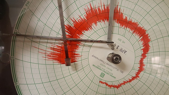
Hays Chart showing our peak gust of 131 mph at 8:19pm EDT.
Caleb Meute, Weather Observer / Meteorologist

Seek the Peak Spotlight: The Cloud Chasers
Seek the Peak Spotlight: The Cloud Chasers By MWOBS Staff Mike Bergeron and Desiree Bolton have been participating and volunteering for Seek the Peak for three years now. Together, they comprise Team Cloud Chasers

Celebrating 250 Years: The Declaration’s Legacy in the White Mountains
Celebrating 250 Years: The Declaration's Legacy in the White Mountains By Peter Crane We are now approaching July Fourth, Independence Day, the day when we celebrate the adoption of the Declaration of Independence in

Seek the Peak Spotlight: Ryan Shepard
Seek the Peak Spotlight: Ryan Shepard By MWOBS Staff Before Ryan Shepard moved to Conway, he was in Western New York celebrating his 40th birthday party. “I wanted to go big,” he said. “Big”
