Forecast Discussion is Key to Interpreting Complex Mountain Weather
As a meteorologist, I’ve had opportunities to forecast for a wide variety of environments and audiences. From the roads of Vermont to the valleys of California and climbers ascending Mount Everest, I’ve learned a lot about forecasting. At least that’s what I believed before starting to predict the weather at New England’s highest summit.
In my few months here, I’ve been humbled on several occasions when forecasting this mountain’s dynamic weather. Mount Washington has taken me to task.
What I am going for here is not the sympathy of the reader, nor is it to reinforce the age-old and wildly inaccurate saying that “a meteorologist is the only person who can get paid to be wrong 50% of the time and keep their job.” Instead, I want to talk about our Higher Summits Forecast and how to read and interpret it.
We issue this forecast twice a day for the Presidential Range. While it includes variables like temperature, cloud cover, wind speed, wind chill, and precipitation, the most important part is the forecast discussion.
I get it, we live in a world where most of our weather-related decisions revolve around mobile apps, which typically have cozy little icons of expected weather, icons that in my opinion have far too much sway over our choices. Another pet peeve is how these apps put so much focus on exact numbers. I have seen parties and even weddings called off because of a water droplet icon paired with a 50% chance of rain!
What such apps fail to communicate is the uncertainty. Weather is a complex system controlled by countless variables. The app on your phone? Well, it’s simply the average of a handful of computer models and is subject to frequent changes.
Many people who visit the summit after reading our Higher Summits Forecast focus a lot of attention on the numbers in our daily outlook. Maybe it’s a product of the app-based world of weather.
What I’d like to draw your attention to is the Forecast Discussion portion of our Higher Summits Forecast, which includes a bit of science and strives to communicate the uncertainties inherent in mountain weather. Even though we’re all passionate and knowledgeable about the weather up here on the Rockpile, we have all gotten it wrong from time to time. That’s why the forecast discussion is such a useful tool in describing our thought processes as we analyze all of the variables, including the powerful role the White Mountains play in influencing weather. These thought processes come from lessons we have learned from previous forecasting errors.
Let’s look at a recent forecast discussion as an example:
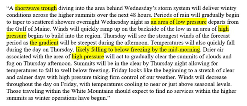
The first thing you may notice about this discussion is how short it is. Our goal as forecasters is to make the complexities of the atmosphere quick and digestible for those who want to take on the Presidential Range. You wouldn’t typically expect much from 212 words, but this discussion is packed with information.
Our discussions contain information about relevant weather features, which you can think of as “players on the field.” I’ve highlighted each of these players and will discuss them in greater detail.
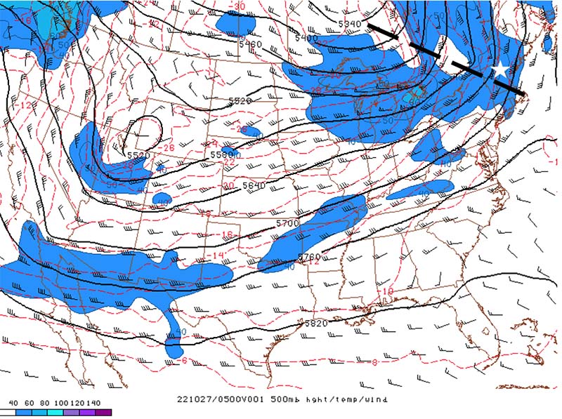
A shortwave trough, or “shortwave,” is a narrow area of colder air in the upper atmosphere. Smaller than its longwave cousin, the shortwave can cause all kinds of mischief mainly in the form of lower pressure and precipitation. In this particular instance, a shortwave (dashed line) was located just to the west of the summit (white star). This shortwave was responsible for bringing the summits strong winds and much colder temperatures.
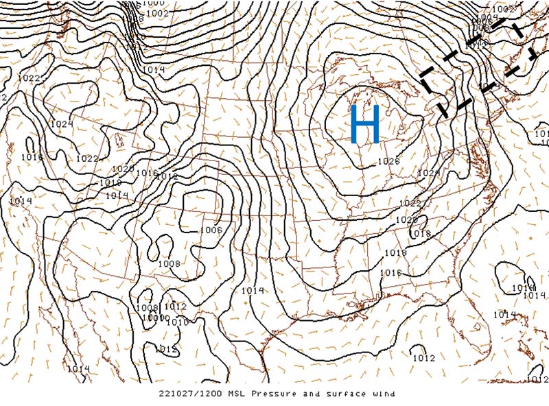
Heading down closer to home in the lower atmosphere, let’s take a look at surface air pressure. The map below is not an abstract piece of art; rather, it is a display of what we call isobars. Each solid black line indicates an area of equal pressure. The rule of thumb here is the tighter the isobars are packed together, the stronger the winds are. This is the pressure gradient that is mentioned in the forecast. As this gradient strengthened, winds on the summit increased to over 60 within a few hours.
The other important variable mentioned in this particular forecast discussion is the summit temperature; it mentions below freezing temperatures by mid-morning. We laser focus on the timing of crossing such a temperature threshold because just a few tenths of a degree can mean the difference between wet rocks and a dangerously icy summit. For this particular event, you can see just how quickly temperatures changed. In just 30 minutes, the temperature fell from above 35 degrees to below freezing. Conditions on the summit went from damp to downright dangerous in a matter of minutes as standing water and droplets alike froze solid.

There is a reason for the discussion portion of the Higher Summits Forecast, and that reason is the same reason for the bright yellow warning sign at the beginning of the alpine zone. Simply put, Mount Washington and the surrounding summits are home to some of the worst and most variable weather in the world. Whenever you head into the White Mountains, take a moment to read our Higher Summits Forecast, including the discussion, at mountwashington.org.
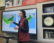
Learn more about forecasting in my recent Virtual Classroom program about Predicting the Weather.
Francis Tarasiewicz, Weather Observer & Education Specialist
Three and a Half Months of Snow, Ice and Rime
Three and a Half Months of Snow, Ice and Rime, with Deeper Drifts. By Ryan Steinke Me outside on the summit near the Yankee Building. My internship with the Mount Washington Observatory
Supporter Spotlight: Righteous Vices Coffee Roasters
Supporter Spotlight: Righteous Vices Coffee Roasters By MWOBS Staff Righteous Vices Coffee Roasters, a local coffee roaster and shop located in Center Conway, New Hampshire, has been a partner of the Observatory since 2024.
Winter Storm Tracks Across New Hampshire
Winter Storm Tracks Across New Hampshire By Alex Branton As winter comes to a close, most of us are ready for the warmer temperatures and sunshine that come with Spring and Summer. Although we

