
Hurricane Joaquin
2015-09-30 16:17:39.000 – Mike Carmon, Co-Director of Summit Operations
Hurricane season is in full swing, and there’s a storm in the Atlantic Basin that’s beginning to nose its way into the headlines.
That storm is Hurricane Joaquin.
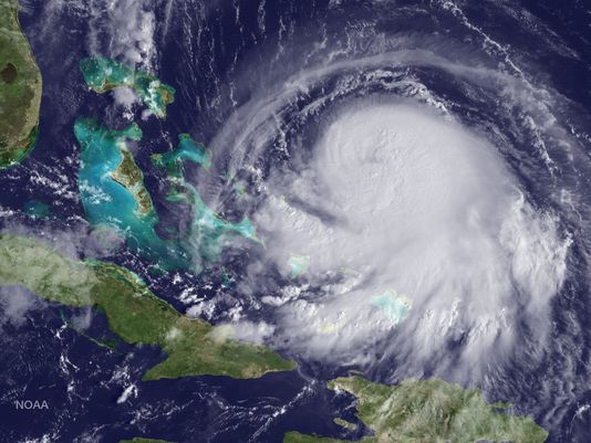
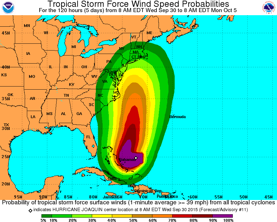
As of 2PM EDT, Joaquin is a Category 1 Hurricane, with maximum sustained winds upwards of 85MPH. Joaquin is positioned northeast of the Bahamas, currently moving towards the southwest.
Hurricane Joaquin has strengthened quite a bit today, and is expected to continue this strengthening trend as its environment becomes much more conducive for tropical development.
Although Joaquin is currently moving southwest, a developing trough over the southeastern United States will prompt the system to make a sharp turn towards the north within the next 2 days.
After the northward turn, there is considerable uncertainty in the computer models as to how far north Joaquin will migrate before it makes a more westward turn towards the continental United states. As of right now, 2 scenarios in particular look likely:
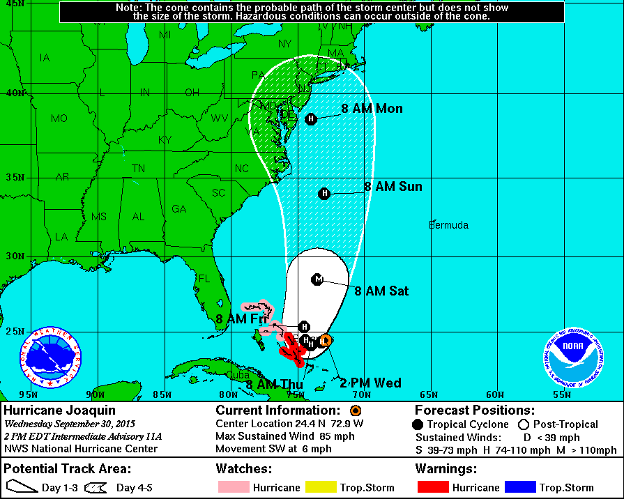
Either way, Joaquin now bears considerable watching for most of the eastern seaboard, from Georgia to Maine. Although one of these two scenarios could play out, or perhaps even a different one, hurricanes are large systems, so effects from it’s landfall will extend out hundreds of miles from where the eye ultimately comes ashore.
As for Joaquin’s potential effects on the White Mountain Region-it’s still far too early to tell with any certainty, but a landfall on the eastern seaboard could bring the remnants of the storm through New England sometime in the middle of next week, which could mean another round of very heavy rain for the region.
For now, all eyes are on Joaquin.
Mike Carmon, Co-Director of Summit Operations

Celebrating 250 Years: The Declaration’s Legacy in the White Mountains
Celebrating 250 Years: The Declaration's Legacy in the White Mountains By Peter Crane We are now approaching July Fourth, Independence Day, the day when we celebrate the adoption of the Declaration of Independence in

Seek the Peak Spotlight: Ryan Shepard
Seek the Peak Spotlight: Ryan Shepard By MWOBS Staff Before Ryan Shepard moved to Conway, he was in Western New York celebrating his 40th birthday party. “I wanted to go big,” he said. “Big”

From Florida Heat to the Rockpile
From Florida Heat to the Rockpile By Alek Libby Hi everyone! My name is Alek Libby, and I am one of the summit interns here at Mount Washington Observatory this summer! I recently graduated
