
June Snow on the Horizon?
2019-05-30 16:45:49.000 – Thomas Padham, Weather Observer/Education Specialist
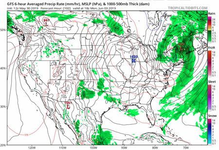
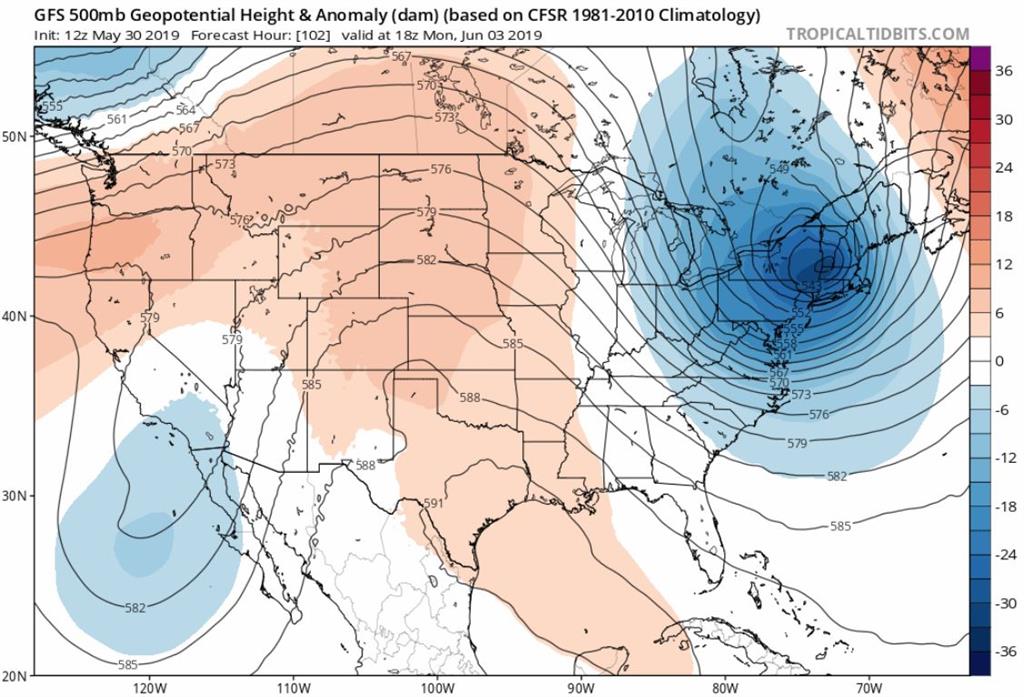
An anomalous upper level trough of low pressure has been in the models for the past several days, looking to park itself over New England Monday and Tuesday. This trough will lead to a slow moving low pressure system at the surface, with chilly air for this time of year diving in from near Hudson Bay down into northern New York and New England.
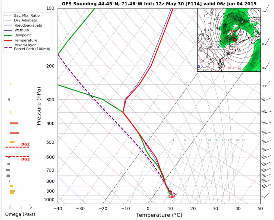 GFS Model soundings showing temperatures (red line) at Mount Washington’s level (800 mb) right at the freezing mark with precipitation Monday night through Tuesday morning. Image courtesy of Tropical Tidbits.
The cold air will be pretty marginal for all but the highest elevations of the Adirondacks of New York and White Mountains, and this may end up being an event where only the summit of Washington is tall enough for snow to accumulate. The exact position of the surface low will also be key, as of right now it has mostly trended right over New Hampshire between each model update but a trend further east would mean a better chance for snow. We’ll certainly keep an eye on how this system develops in the coming days, but it could be exciting to kick off meteorological summer with a little snow!
Thomas Padham, Weather Observer/Education Specialist

Seek the Peak Spotlight: The Cloud Chasers
Seek the Peak Spotlight: The Cloud Chasers By MWOBS Staff Mike Bergeron and Desiree Bolton have been participating and volunteering for Seek the Peak for three years now. Together, they comprise Team Cloud Chasers

Celebrating 250 Years: The Declaration’s Legacy in the White Mountains
Celebrating 250 Years: The Declaration's Legacy in the White Mountains By Peter Crane We are now approaching July Fourth, Independence Day, the day when we celebrate the adoption of the Declaration of Independence in

Seek the Peak Spotlight: Ryan Shepard
Seek the Peak Spotlight: Ryan Shepard By MWOBS Staff Before Ryan Shepard moved to Conway, he was in Western New York celebrating his 40th birthday party. “I wanted to go big,” he said. “Big”
