
NULL
2010-08-02 17:23:56.000 – Stacey Kawecki, Observer and Meteorologist
shiny
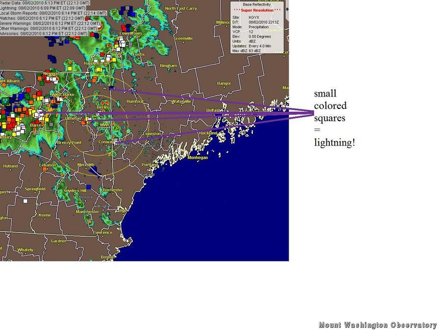
Who ever knew that small colored squares could ever invoke such excitement amongst the summit dwellers? It’s amusing how merely seeing the little squares approach the center circle on a screen seems to fill the room with electricity, especially since the squares symbolize cloud to ground lightning strikes.
After a rather chilly start to the week, high pressure has slid offshore and is moving slowly south. The resulting southwest flow opened the gates to the warm, moist air in the Gulf of Mexico. The daytime heating, shortwave trough, and the fact that the air is pushed up and over mountains (a lifting mechanism) provided ideal conditions for isolated thunderstorms. However, there really isn’t too much upper level support; as darkness descends, the intensity of the storms will diminish.
Tomorrow we’ll probably see a similar storm situation. With warm air in place, day time heating, and another shortwave approaching, storm development will likely occur in the late afternoon. Even if the lightning doesn’t quite reach the summit, as long as those small, colored squares pop up on the radar screen, the observers, interns, and volunteers will find something to spark their interest.
Stacey Kawecki, Observer and Meteorologist

Celebrating 250 Years: The Declaration’s Legacy in the White Mountains
Celebrating 250 Years: The Declaration's Legacy in the White Mountains By Peter Crane We are now approaching July Fourth, Independence Day, the day when we celebrate the adoption of the Declaration of Independence in

Seek the Peak Spotlight: Ryan Shepard
Seek the Peak Spotlight: Ryan Shepard By MWOBS Staff Before Ryan Shepard moved to Conway, he was in Western New York celebrating his 40th birthday party. “I wanted to go big,” he said. “Big”

From Florida Heat to the Rockpile
From Florida Heat to the Rockpile By Alek Libby Hi everyone! My name is Alek Libby, and I am one of the summit interns here at Mount Washington Observatory this summer! I recently graduated
