
Plenty of Snow to Go Around
2015-02-23 17:11:50.000 – Adam Freierman, Summit Intern
An excellent school vacation week for skiing, with some sunny days and plenty of fresh snow, ended with a bang as yet another storm delivered on Saturday night. With snow falling heavily at times, and that dreaded mixed precipitation remaining far away from New Hampshire’s ski areas, skiers across the state found at least 2” of new snow awaiting them on the slopes Sunday morning, with most resorts more in the 4-8” range. On top of last Wednesday’s snow this means that packed powder conditions on a 2-5’ base remains the norm in the Granite State, making for fantastic skiing at all of your favorite mountains.
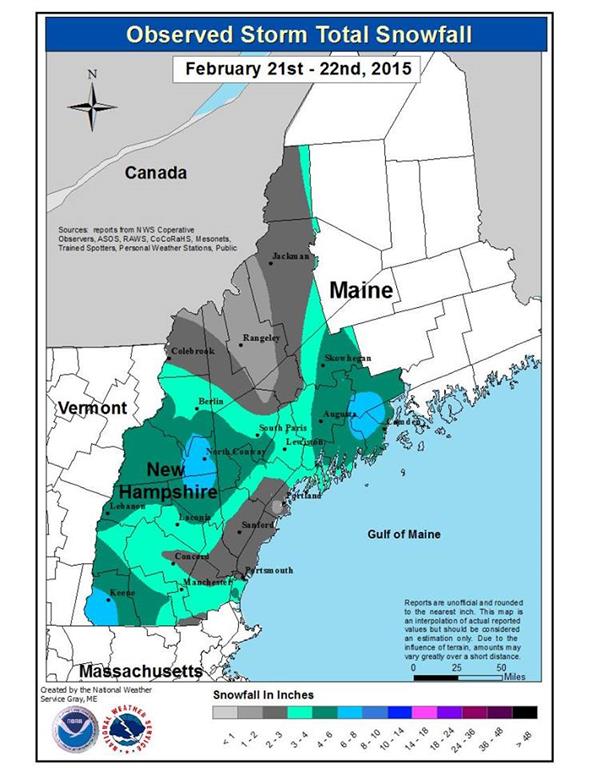
Observed Snowfall map courtesy of the National Weather Service, Gray, Maine.
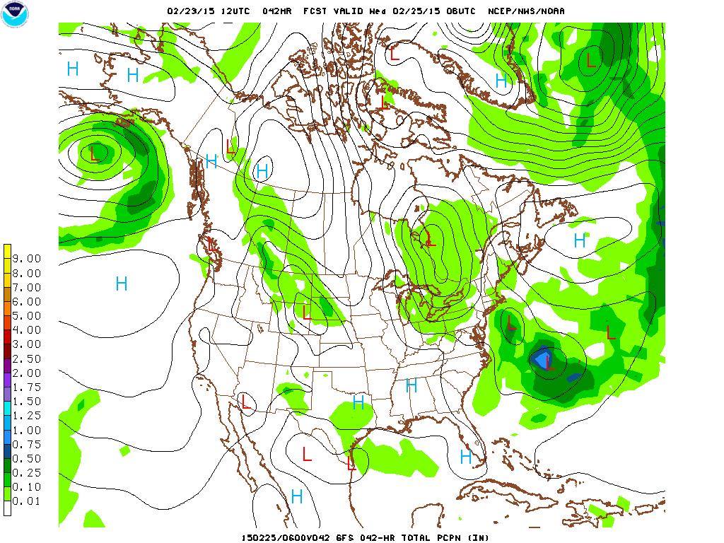
Wednesday February 25, 1am: Surface level forecast map showing two centers of low pressure, approaching from the Great Lakes and one from the Mid-Atlantic, converging over northern New England.
Although temperatures will remain slightly below average this week, there should be some bright sunny days to help things feel a bit warmer. The active weather pattern will continue over the next week, with a couple more storms on the horizon continuing to add on to our already impressive snowpack.
Adam Freierman, Summit Intern

Mountains and Meteorology: What More Could a Girl Need?
Mountains and Meteorology: What More Could a Girl Need? By Emily Grainger Hi everyone! My name is Emily Grainger, and I am one of this fall’s Summit Interns atop Mount Washington! I’m from Orlando,

My Fear of Weather Became a Love of Meteorology
My Fear of Weather Became a Love of Meteorology By Kaitlin Farrell Hello! My name is Kaitlin Farrell. I am one of the fall summit interns here at Mount Washington Observatory. I recently graduated

Ascending with High Winds
Ascending with High Winds By Alonso Lopez Hi! I am Alonso Lopez, one of four interns at Mount Washington Observatory from August to December, 2026. I was born and raised in the Dallas-Fort Worth