Summer, Then Back to Winter
2015-04-02 16:59:51.000 – Mike Carmon, Interim Director of Summit Operations
With the spring season in full swing, those infamous April showers are to be expected, and the next few days will be no exception to that. However, glimpses of winter will continue to nose their way into the forecast from time to time.
A strong warm front will approach the region tonight, ushering in some of the mildest air the region has experienced since the turn of the new year! High temperatures soaring into the upper 50s are likely as far north as the Berlin/Gorham area on Friday, with readings well into the 60s throughout southern New Hampshire. Along with these warmer temperatures, rain will overspread the area, lasting through the early part of Friday, with even the summit of Mt. Washington experiencing plain rain for a time!
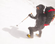
However, this summer preview will not last long, as an area of low pressure off the coast rapidly deepens and pushes a strong cold front through New England. This will bring an abrupt end to those relatively-balmy temperatures, prompting precipitation to change back to snow on the summit as the mercury tumbles back into the sub-zero realm. If the low sets up just right, a significant amount of snow could be seen on the higher summits by late Saturday.
Mike Carmon, Interim Director of Summit Operations
Bringing Polar Byrd I to Mount Washington
Bringing Polar Byrd I to Mount Washington By Jackie Broccolo In 1968, my grandfather joined the Polar Byrd I “Dustin Transpolar Flight”, which was the first commercial flight to carry civilians across both poles
Seek the Peak 2026: New Adventures, Rooted in Tradition
Seek the Peak 2026: New Adventures, Rooted in Tradition By MWOBS Staff Seek the Peak is Mount Washington Observatory's largest annual fundraiser, and for 26 years it's brought together hikers, adventurers, and people who
What “Prepared” Really Means in the White Mountains
What “Prepared” Really Means in the White Mountains Early Spring in the Whites: The Most Honest Season By Andrew Harris, Burgeon Outdoor If you’ve spent any time in New Hampshire’s White Mountains in March,


