
Sunny and Mild
2015-04-13 06:28:12.000 – Ryan Knapp, Weather Observer/Staff Meteorologist
If one had to summarize Monday in three words it would be “sunny and mild.” While these three words will be departing our vocabulary a bit Monday night into Tuesday, they will be returning to the region for the midweek. High pressure, which will be providing the fair weather on Monday, will be sliding offshore heading into Monday night as a low approaches to our northwest. As the low passes to our north, it will be dragging a trailing weak cold front with it, which will approach from the west. As this front passes, it will bring some light rain showers to the lower elevations Monday night into Tuesday. For higher elevations, rain will be seen at the start, however some peaks may see a wintry mix on Tuesday as a secondary cold front swings through. As the front exits, high pressure will be rebuilding from the west for Wednesday and Thursday bringing a return of spring-like conditions and those three magical words – sunny and mild. Looking further ahead though, unsettled weather will then be returning as we head into the weekend.
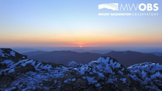 The view at the start of the sunny and mild Monday.
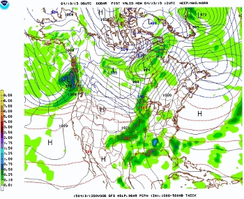 Monday – High pressure exiting and a cold front approaching from the west.
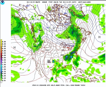 Tuesday – A cold front and associated rain showers sweep through the East.
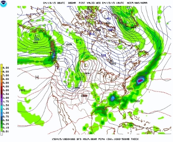 Wednesday – High pressure returns and with it, sunny and mild conditions.
Ryan Knapp, Weather Observer/Staff Meteorologist

Celebrating 250 Years: The Declaration’s Legacy in the White Mountains
Celebrating 250 Years: The Declaration's Legacy in the White Mountains By Peter Crane We are now approaching July Fourth, Independence Day, the day when we celebrate the adoption of the Declaration of Independence in

Seek the Peak Spotlight: Ryan Shepard
Seek the Peak Spotlight: Ryan Shepard By MWOBS Staff Before Ryan Shepard moved to Conway, he was in Western New York celebrating his 40th birthday party. “I wanted to go big,” he said. “Big”

From Florida Heat to the Rockpile
From Florida Heat to the Rockpile By Alek Libby Hi everyone! My name is Alek Libby, and I am one of the summit interns here at Mount Washington Observatory this summer! I recently graduated
