
Tracking Hurricane Matthew
2016-10-03 17:12:37.000 – Tom Padham, Weather Observer/Meteorologist
Although it is still nearly 2,000 miles to our south, Hurricane Matthew is looking more and more likely to impact New England and much of the eastern seaboard next weekend. The hurricane is currently located over the Caribbean Sea and moving northward towards Haiti, Jamaica, and eastern Cuba with sustained winds as high as 140 mph. Potentially life threatening conditions will occur over these areas from high winds, storm surge, and flash flooding through Wednesday. Models will continue to come into better agreement over the next few days and especially after the storm crosses Cuba and moves into the Bahamas. At this time, at the very least, Matthew will likely produce very heavy rainfall (potentially in excess of a foot) and gusty winds across the White Mountains even if the center of the storm tracks well offshore due to interactions with low pressure over southeastern Canada as the storm approaches the Northeast.
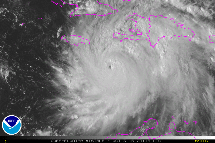 Visible satellite imagery of Matthew approaching Haiti and Jamaica
On the summit, at this time rain looks to fall heavily over the weekend, with the potential for winds in excess of 100 mph. Please be sure to monitor the status of both the Mount Washington Cog Railway and Mount Washington Auto Road for any changes to their operating schedules heading into this holiday weekend. For now we’ll continue to monitor the evolution of this powerful hurricane; luckily we have several days to track its progress and also prepare before the Saturday-Sunday predicted time frame of the onset of the storm in New England. Be sure to check our higher summits forecast over the coming days!
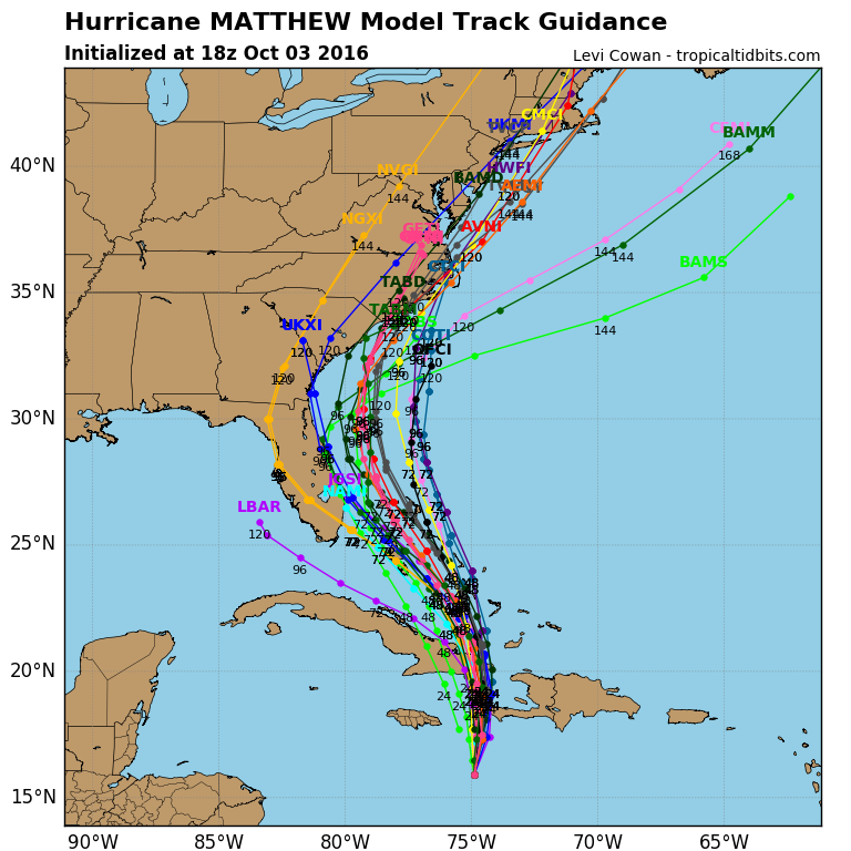 Model guidance for the track of Matthew this afternoon
Tom Padham, Weather Observer/Meteorologist

Seek the Peak Spotlight: The Cloud Chasers
Seek the Peak Spotlight: The Cloud Chasers By MWOBS Staff Mike Bergeron and Desiree Bolton have been participating and volunteering for Seek the Peak for three years now. Together, they comprise Team Cloud Chasers

Celebrating 250 Years: The Declaration’s Legacy in the White Mountains
Celebrating 250 Years: The Declaration's Legacy in the White Mountains By Peter Crane We are now approaching July Fourth, Independence Day, the day when we celebrate the adoption of the Declaration of Independence in

Seek the Peak Spotlight: Ryan Shepard
Seek the Peak Spotlight: Ryan Shepard By MWOBS Staff Before Ryan Shepard moved to Conway, he was in Western New York celebrating his 40th birthday party. “I wanted to go big,” he said. “Big”
