
Walking In A Winter Wonderland…Almost
2017-09-10 17:23:05.000 – Nicole Tallman, Summit Intern
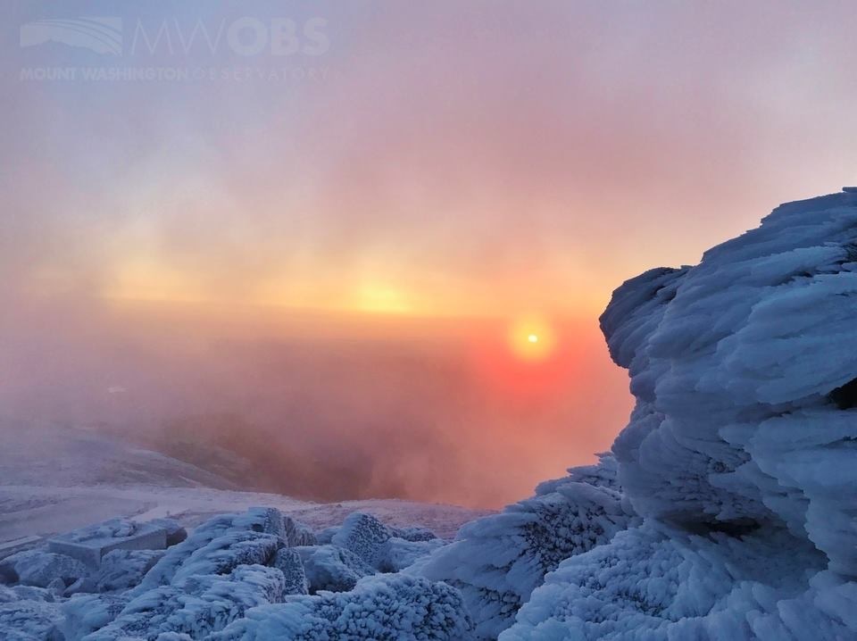
With the changeover to meteorological fall comes the increased possibility for snow on the summit of Mount Washington. During my time on the summit as the summer intern I was able to truly experience snow and icing only once at the very beginning of my internship. The summit seemed to be a winter wonderland with everything covered in frozen precip; whether it is ice or what was left of the blowing snow. With my experiences from that one event, I am positive that when this winter season fully comes underway I will be in awe of the beauty of the snow and ice.

Mount Washington’s winter is longer than the typical winter season. The season ranges from October to May averaging a whopping 281 inches of snowfall. With the winter season coming fast and the first few snowfalls this season underway it is the perfect time to understand the beauty behind these frozen flakes.
The typical visualization of snow is a beautiful, lacey, symmetrical snow flake. While this may be one type of snow crystal it is not the only type that can form. Snow may fall in many different shapes and sizes depending on its unique path through a cloud. Changes in temperature and moisture will grow different shapes and sizes of snow crystals. A single cloud does not have uniform moisture or temperature within it. Therefore, the same cloud can produce differently shaped snow crystals.

Looking at the visual above it is clear that there are a variety of shapes to snow crystals, not just the dendrite that we are all so familiar with. For example, temperatures from around 10 to 20 degrees Fahrenheit can produce needles, columns and prisms while colder temperatures from -10 to -20 degrees Fahrenheit will produce columns and plates. The moisture within the cloud will have a direct correlation to the size of the crystal; more moisture can produce larger crystals. Along with moisture there are two other ingredients needed to produce a snow crystal. Snow will form with water vapor, dust (in the form of pollen, volcanic ash or other particles in the sky), and ice crystals. These three ingredients along with the right meteorological conditions will produce snow.
The snow typically seen on the summit of Mount Washington is produced with temperatures ranging from -10 degrees to 10 degrees Fahrenheit. This means that we see many of the familiar dendrites as well as plates.
Last winter the summit received 401 inches of snow which was 120 inches above average making it the 6th snowiest winter on record. The most significant storm that hit the summits was at the end of their winter season and fell on Mother’s day from May 14th through the 15th dumping 33 inches of snow! It was a very impressive winter (still not enough to satisfy our snow enthusiast observer, Adam)!

Nicole Tallman, Summit Intern

Seek the Peak Spotlight: The Cloud Chasers
Seek the Peak Spotlight: The Cloud Chasers By MWOBS Staff Mike Bergeron and Desiree Bolton have been participating and volunteering for Seek the Peak for three years now. Together, they comprise Team Cloud Chasers

Celebrating 250 Years: The Declaration’s Legacy in the White Mountains
Celebrating 250 Years: The Declaration's Legacy in the White Mountains By Peter Crane We are now approaching July Fourth, Independence Day, the day when we celebrate the adoption of the Declaration of Independence in

Seek the Peak Spotlight: Ryan Shepard
Seek the Peak Spotlight: Ryan Shepard By MWOBS Staff Before Ryan Shepard moved to Conway, he was in Western New York celebrating his 40th birthday party. “I wanted to go big,” he said. “Big”
