
Weekly Weather Summary Nov. 13 – 19
2011-11-21 08:45:45.000 – Rick Giard, Weather Observer / Education Specialist

NULL
WEEKLY WEATHER SUMMARY
November 13th – 19th
This week began with fair conditions and seasonal temperatures under the influence of high pressure. As the ridge moved off to the east, the corresponding southwesterly flow moderated temperatures to above-normal levels. With mild air in place, the frontal system moving in from the west on Monday produced light rain and fog. Behind the front on Tuesday, cooler air imported on the westerly flow prompted the mercury to slip below freezing by late morning. Consequently, the fog that persisted for the entire day generated several hours of glaze which later transitioned to rime with colder conditions. A brief break from the fog ensued late Tuesday night into midmorning Wednesday. However, the fog returned as a mid-Atlantic secondary low formed and pushed the stalled front northward. This spread significant rain across the summits that transitioned to snow and riming fog as temperatures plummeted behind the front.
The air mass that took hold on Thursday produced some of the coldest conditions of the season to date, ushered in by a late-day reinforcing upper-level disturbance. Temperatures gradually fell through the teens, eventually settling in the upper single digits. The upper level trough also generated significant snow showers that evening, which persisted through midday Friday. Measured snowfall was nearly 4 inches for this activity. Friday proved to be quite frigid, as the cold air combined with moderately high winds to create wind chills well below zero along with substantial rime accumulations. High pressure took hold once again late in the day and into Saturday, setting up a sunny day with moderating temperatures on the return flow. Winds, however, remained strong as the pressure gradient tightened between the building high and the departing low.
To access the complete weekly weather summary, including daily statistics, please click here.
Rick Giard, Weather Observer / Education Specialist

From Florida Heat to the Rockpile
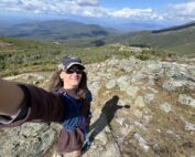
From Florida Heat to the Rockpile By Alek Libby Hi everyone! My name is Alek Libby, and I am one of the summit interns here at Mount Washington Observatory this summer! I recently graduated
Summit Summer
Summit Summer By Aspen M. Hello everyone! My name is Aspen, I’m one of the summer weather interns here at the Mount Washington Observatory. I fell in love with weather at a young age
From the Sunshine State to the Home of the World’s Weather
From the Sunshine State to the Home of the World's Weather By Kristen Mihalcik Hello Everyone! My name is Kristen Mihalcik, and I’m one of the Summer interns here at Mount Washington. Enjoying
