
Winter Storm
2011-11-22 08:50:06.000 – Kevin Cronin, Summit Intern
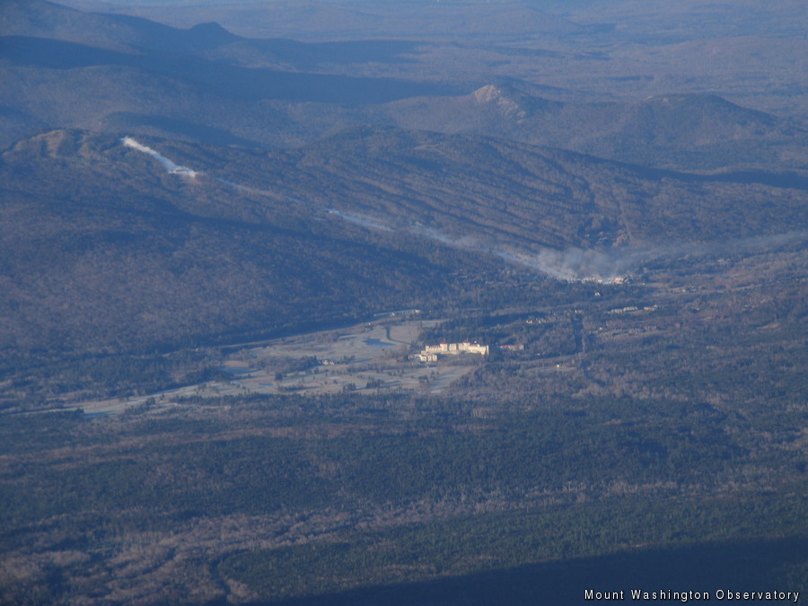
A base layer of snow before the storm arrives
The top of Mount Washington is bare of snow besides a few spots of snow here and there. However, this will surely change in the next 24 hours as a winter storm approaches from the southwest. Bretton Woods ski resort is already preparing by putting down a base layer of snow before the storm arrives tomorrow. A plume of artificial snow can be seen from the image I attached. Winter storm warnings are in effect for most of northern New Hampshire as the models predict a favorable track for snow. Cold air damming and evaporative cooling will prevail over warm air advection produced by the storm allowing the majority of the precipitation to be snow in northern New Hampshire. Traveling farther south in New Hampshire snow will begin to mix with ice pellets and rain as warm air advection provides a warmer layer aloft warming temperatures above freezing. Models are showing snow totals of 10+ inches and less as you head farther south.
This storm couldn’t of picked a worse day for New England seeing that the Wednesday before Thanksgiving is one of the heaviest traveled days. Unfortunately it is bad timing for the summit too due to the fact that our shift change is on Wednesdays. In order to avoid the storm Wednesday, shift change will actually occur today in the afternoon.
Kevin Cronin, Summit Intern

Seek the Peak Spotlight: The Cloud Chasers
Seek the Peak Spotlight: The Cloud Chasers By MWOBS Staff Mike Bergeron and Desiree Bolton have been participating and volunteering for Seek the Peak for three years now. Together, they comprise Team Cloud Chasers

Celebrating 250 Years: The Declaration’s Legacy in the White Mountains
Celebrating 250 Years: The Declaration's Legacy in the White Mountains By Peter Crane We are now approaching July Fourth, Independence Day, the day when we celebrate the adoption of the Declaration of Independence in

Seek the Peak Spotlight: Ryan Shepard
Seek the Peak Spotlight: Ryan Shepard By MWOBS Staff Before Ryan Shepard moved to Conway, he was in Western New York celebrating his 40th birthday party. “I wanted to go big,” he said. “Big”
